Enter the technical description
Type the courses into cells, like a spreadsheet, or paste a title's wording as it's written. Keep the title's photo or PDF open beside the form while you check.
Surbee for Windows plots a land title's technical description, ties it to the official control point, checks closure and area, prints the lot plan, and exports it for CAD and GIS. On your PC, even with no signal.
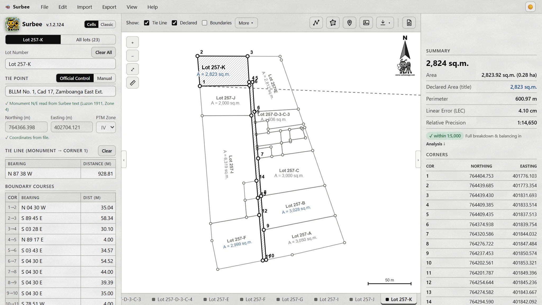
Surbee does the part you'd otherwise do by hand, course by course, before the real work starts.
Type the courses into cells, like a spreadsheet, or paste a title's wording as it's written. Keep the title's photo or PDF open beside the form while you check.
Search the monument by name, like "BLLM No. 1, Cad 17". Surbee fills its Northing, Easting and PTM zone. Built in today: Region 9 (Zamboanga Peninsula) and NIR, with more regions to come.
Linear error of closure and relative precision against the required standard. Compass or transit balancing, and the area in sq.m. and hectares.
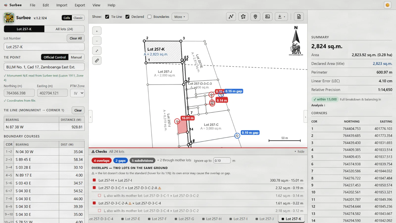
Every lot in its true grid position, one tab each. Mother lots and their sub-lots, a measuring tool, and an Overlaps & Gaps check between neighbours.
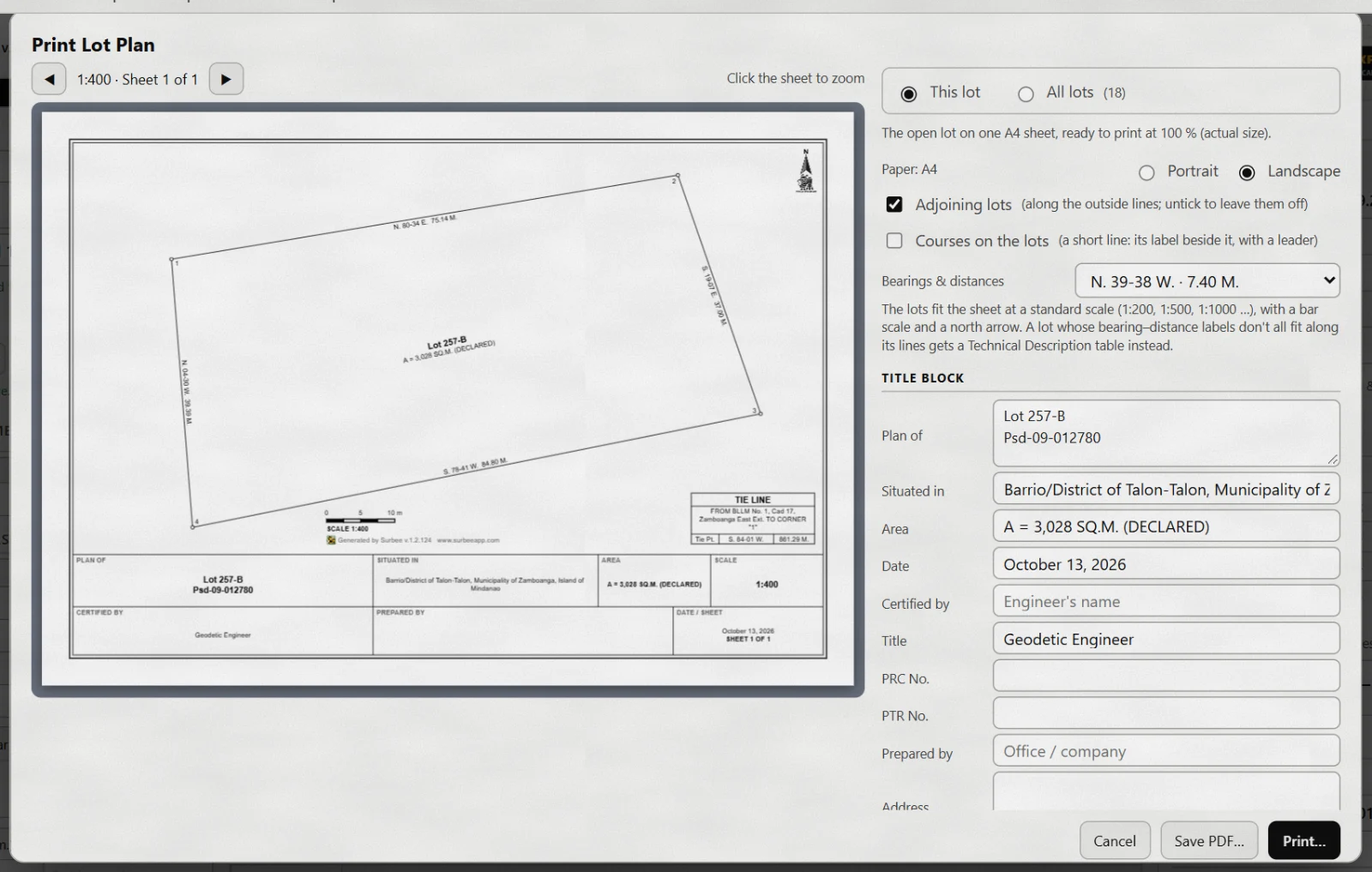
An A4 plan at a standard scale, with the title block, the technical description and tie line tables, and the adjoining lots. Print it or save a PDF.
DXF with layers and text sized to the scale, Shapefile with its projection for QGIS, KML for Google Earth, and PNEZD point lists. For one lot or all of them.
These are from Surbee itself, with a real subdivision plotted from its titles.
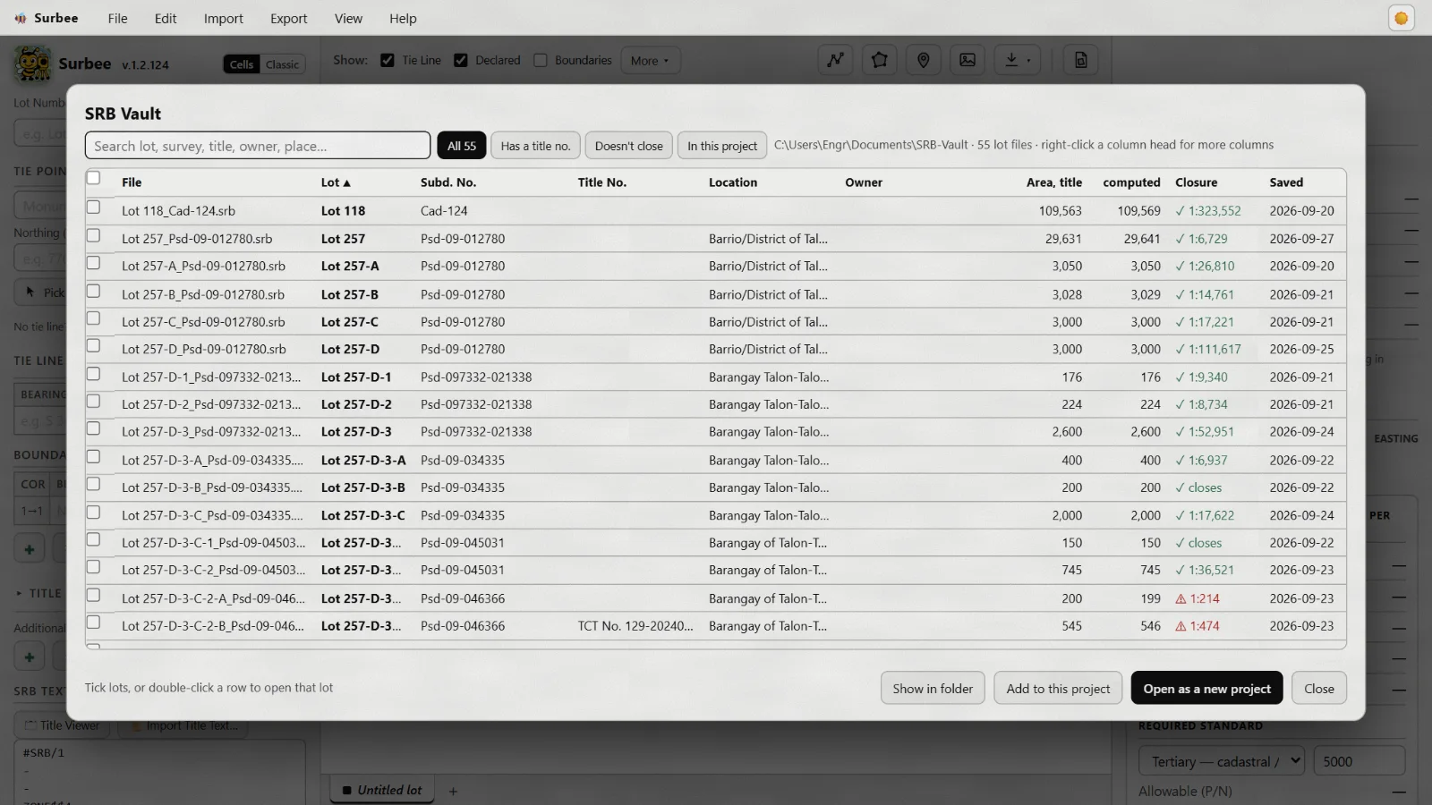
Type or paste the technical description, or open saved lot files. A whole subdivision opens in one go, one tab per lot.
See the lot on the grid next to its neighbours. Read the closure, precision and area, and balance the traverse if it needs it.
Print the Lot Plan, or send the lots to CAD, QGIS or Google Earth. Every lot stays in your SRB Vault for next time.
A Surbee license is yours to keep. No monthly fee, no daily login, nothing that stops you in the field.
Three keys, one for each computer. Install it anywhere; three computers run it.
Plans for a solo GE or a survey office. Pay by GCash or bank transfer.